WATER IS LIFE
The carrying capacity of an ecosystem is the relationship between the availability of available resources and the number of living organisms that can take advantage of them. Although the evaluation of this “Carrying Capacity” is considered “multifactorial”, at the base of every food chain and of every resource availability is… Water.
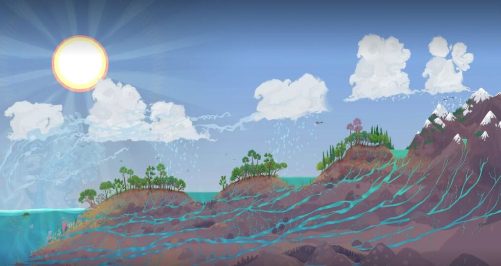
The subsurface water of a landscape, the water found in the first two meters of soil, is what allows the microbiology to be active in the process of Trophobiosis and thus feed the entire Rhizosphere, that large set of roots that can feed and allow the growth of herbaceous, shrub and tree plants. The water present in these first two meters of soil, the humidity, the evapotranspiration of the plant mass, the thermal regulation of both the soil and the convective currents,… make up what is known as the “biotic pump” that attracts more rain, more humidity and more nutrients.
Rain does not come from the sky, it comes from the ground.
All this diverse plant world, fed by the mineral and organic world, allows the life of the animal world; microorganisms, insects, small mammals, herbivores, omnivores, people.

Our landscapes have been in a downward spiral for decades in terms of carrying capacity, we import resources to subsist and the dehydration of the territory increases year after year with the consequences of prolonged droughts, fires and floods.

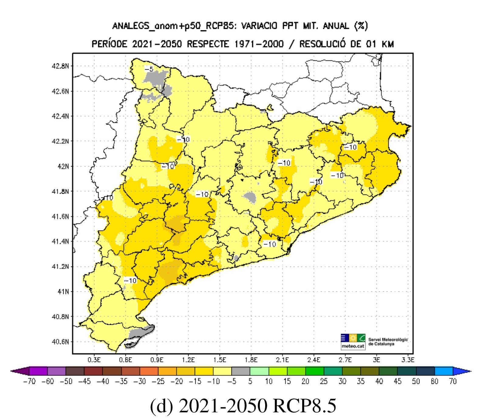
Land management policies at different scales seem to be more focused on water evacuation and increasing the volumes of “blue water“ (surface water intended to supply human consumption – domestic, industrial, and agricultural) than on retention and infiltration. The percentage of water retained and infiltrated, “green water“, is usually 70 to 80% of all the water falling from the sky, to be reincorporated into the hydrological cycle by plant evapotranspiration . Will the management of the headwaters of river basins be sufficiently respectful not to dehydrate our landscapes and break the cycle of the biotic pump?
OBSERVATION AND ANALYSIS
The Climate Change scenarios we are currently facing and those predicted for the future cry out for landscape adaptation, retention and infiltration strategies, not accelerated evacuation; fresh water in the sea can no longer cover the ecological and socioeconomic function it has.
Hydrological Design is a fundamental tool to make our landscapes adaptive and regenerative, so that they can increase their available resources, therefore their productive and “carrying” capacity. It is the basic technique to reestablish the “Biotic Pump” that regulates the hydrological cycle at small and medium scales.
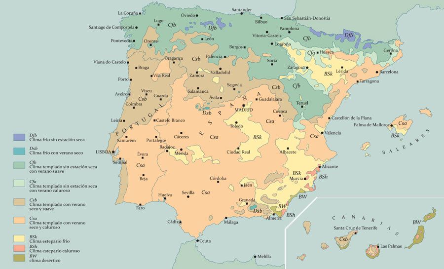
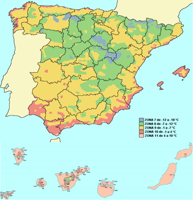
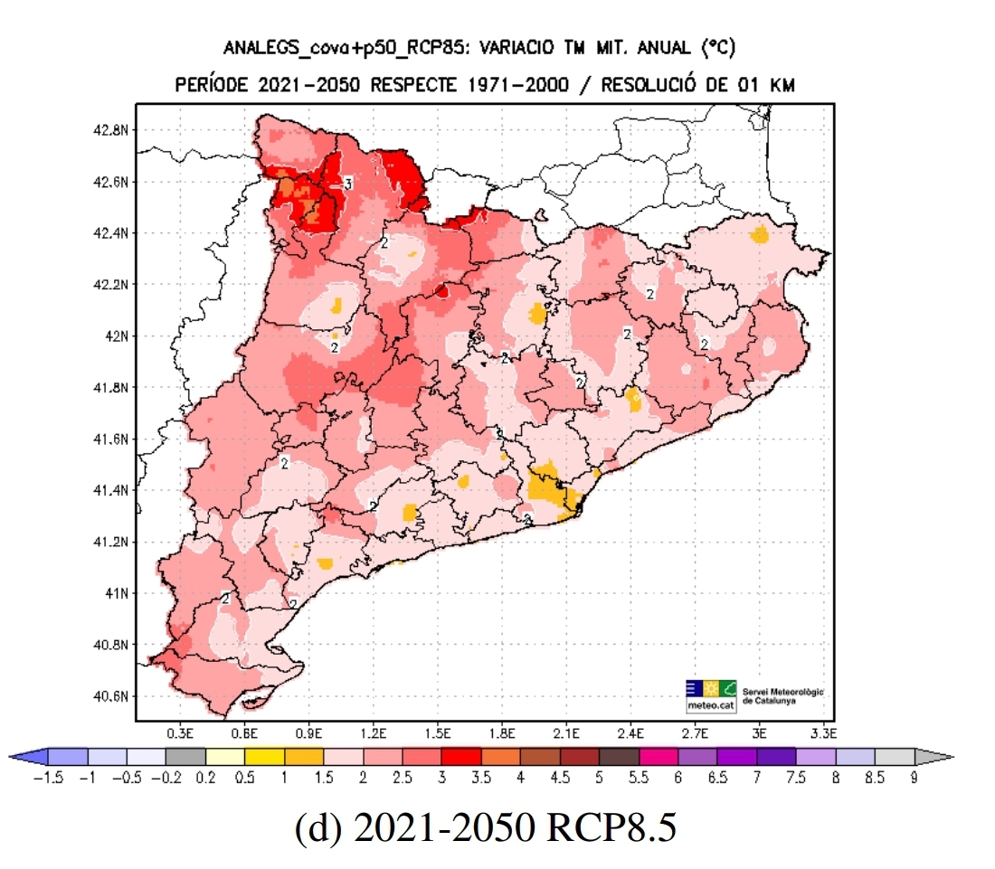
In order to design the regeneration of any land, we must analyze in which Hardiness Zone we are and in which type of Climatic Area. This will allow us to know the range of temperatures and how they are distributed throughout the year; fundamental data for the Vegetation Design that must accompany any Hydrological Design.
The pluviometric range of the last 5 years and the trend for the area according to the study of climate change scenarios, fundamental data to know how many liters per m2 per year can fall on the landscape we are going to design.
After collecting these first data we can identify through visual analysis of the area and special maps which is the “micro watershed“, or several of them, that affects the farm we are going to design and if there have been anthropogenic alterations that have affected that influence; urbanizations, highways, etc. This analysis gives us a better idea of where we can intervene within and also outside the boundaries of the farm, if possible. If it is not possible, it is a“Sector“, an influence that comes from outside the boundaries of the system we are designing for, which we must know how to deal with.
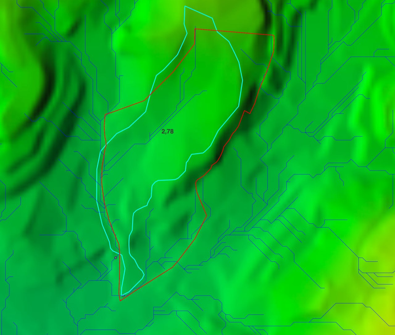
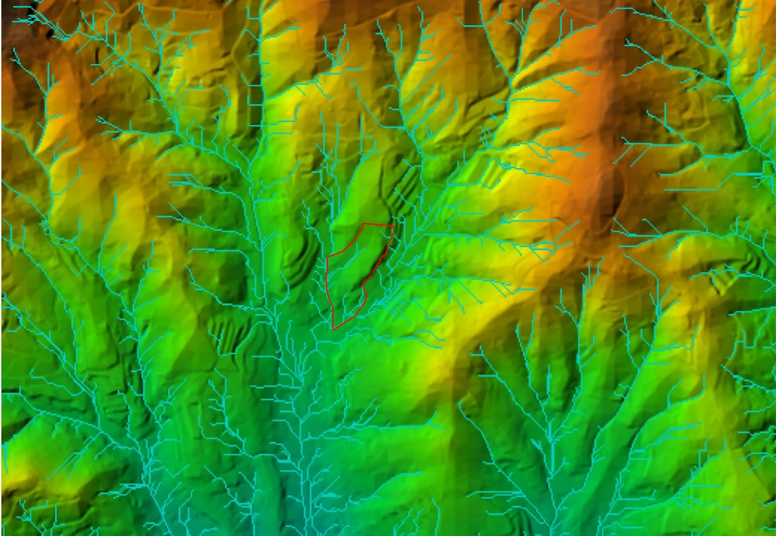
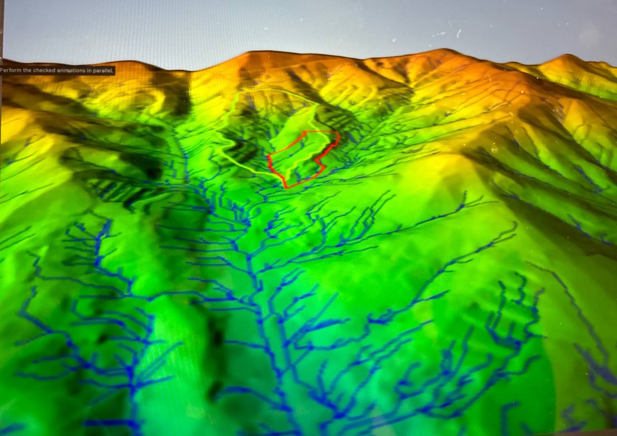
To know how much water we will have to manage, we calculate the surface of the Catchment Area (fields, mountain slopes, terraces, etc.) and choose a runoff coefficient according to the soil texture, slope and plant density.
The final result gives us a clear approximation of how much surface water we can capture and store, in order to design retention and infiltration canals or water bodies in the ground.
Although there is generally a tendency to design to manage runoff, we must also take into account all that subsurface water that moves under our feet. If it does not find retention elements (such as the rhizosphere) it will leave our system and therefore our ability to manage and use it.
The goal can never be to “keep” all the water but to cycle it as many times as possible within our system creating biomass, recharging aquifers, feeding springs, providing ecological niches for all kinds of amphibians, birds and wildlife that maintain the health of ecosystems… and therefore… ours.
DESIGNING INTERVENTIONS
From the field observation we will design on a topographic map the interventions in the 4 areas: topography – water bodies – vegetation design – soil. Always taking into account the contour lines and how they draw the landscape and water flows, we make sure that water can be present in our system for the maximum amount of time possible.
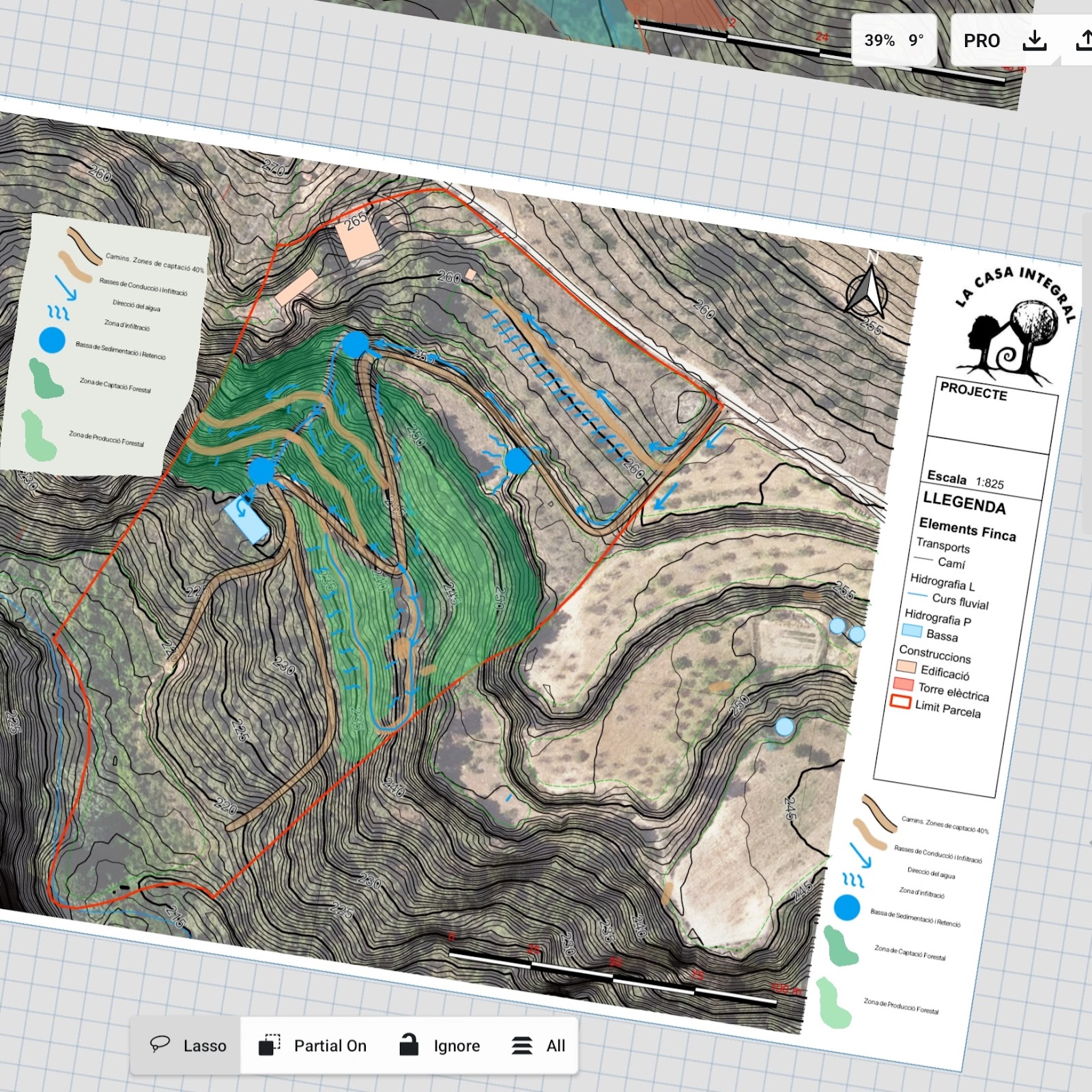
These interventions will be made from the highest possible levels of our management area, paying special attention to:
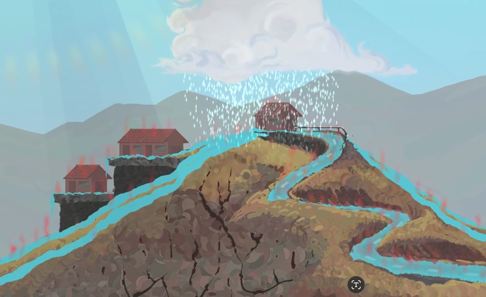
SLOW the flow of water to avoid erosion and the consequent loss of fertility, retaining / cultivating soil with the capture of nutrients.
CONDUCE the water so that it hydrates the landscape on its way and to where we are interested in accumulating or, in the case of the Keyline design, conduct it from where there is water (watercourses and torrents) to the places where there is none (hillsides), playing with the topography.
ACCUMULATE water in water bodies, in a decentralized and unsealed manner to stimulate integration and landscape hydration.
INFILTRATE water in the zone of influence of productive vegetation systems or where we would be interested in the water emerging at lower elevations to feed other elements of the landscape.
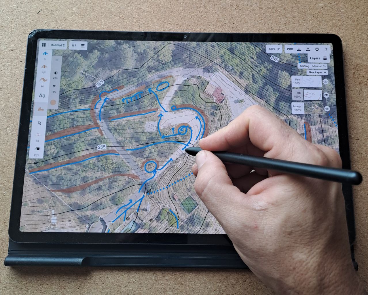
Basically the objective of a Hydrologic Design is to Retain and Infiltrate, Retain and Infiltrate and in between these actions I can Conduct and Accumulate.
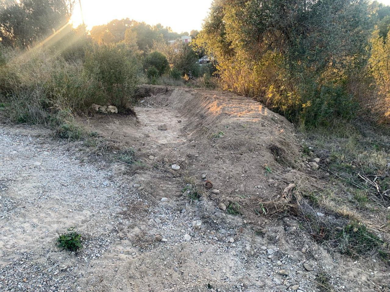
A classic element of a hydrological design can be a “swale” or an infiltration ditch that must always be traced following a contour line (therefore its slope is 0º) and this same element is the one that retains and infiltrates the water.
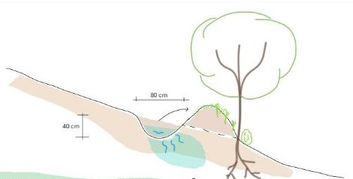
The great challenge of a “swale” is its sizing because in some climates such as the Mediterranean it can go for months without any water inside, so it creates the opposite effect, and because of its walls being open to the air we will have a dehydration of the landscape. In these cases it is recommended to half fill the trench with shredded wood that will help us to create a sponge effect, both to retain the scarce rains for a longer time and also to capture the environmental humidity and avoid dehydration by the exposed internal faces of the swale.
This technique of “mulching” and creating a niche for microbiology could also be used for small accumulation elements (basins distributed in “key points“) in situations where the erratic and not very abundant rainfall would not allow to keep water on the surface for many days a year.
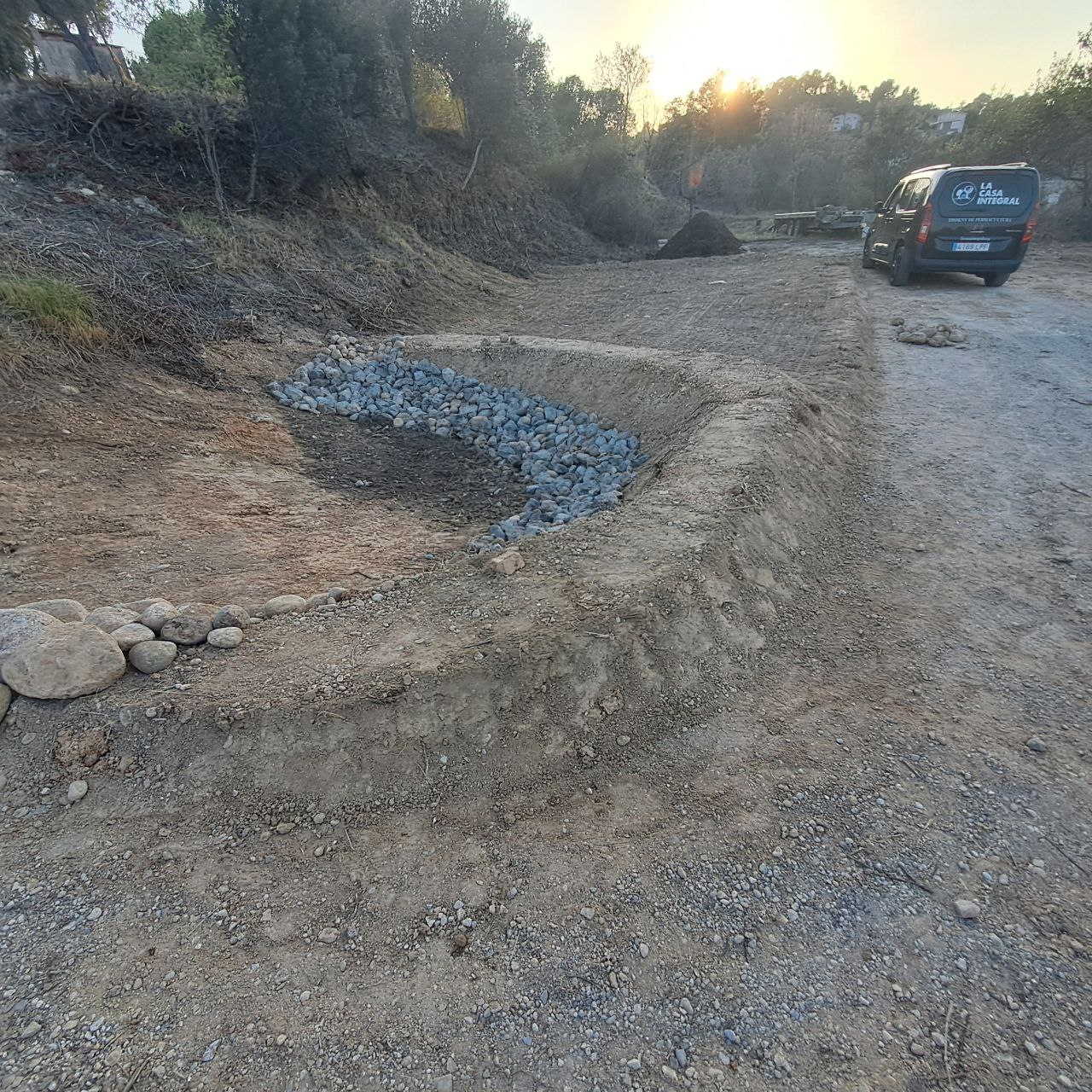
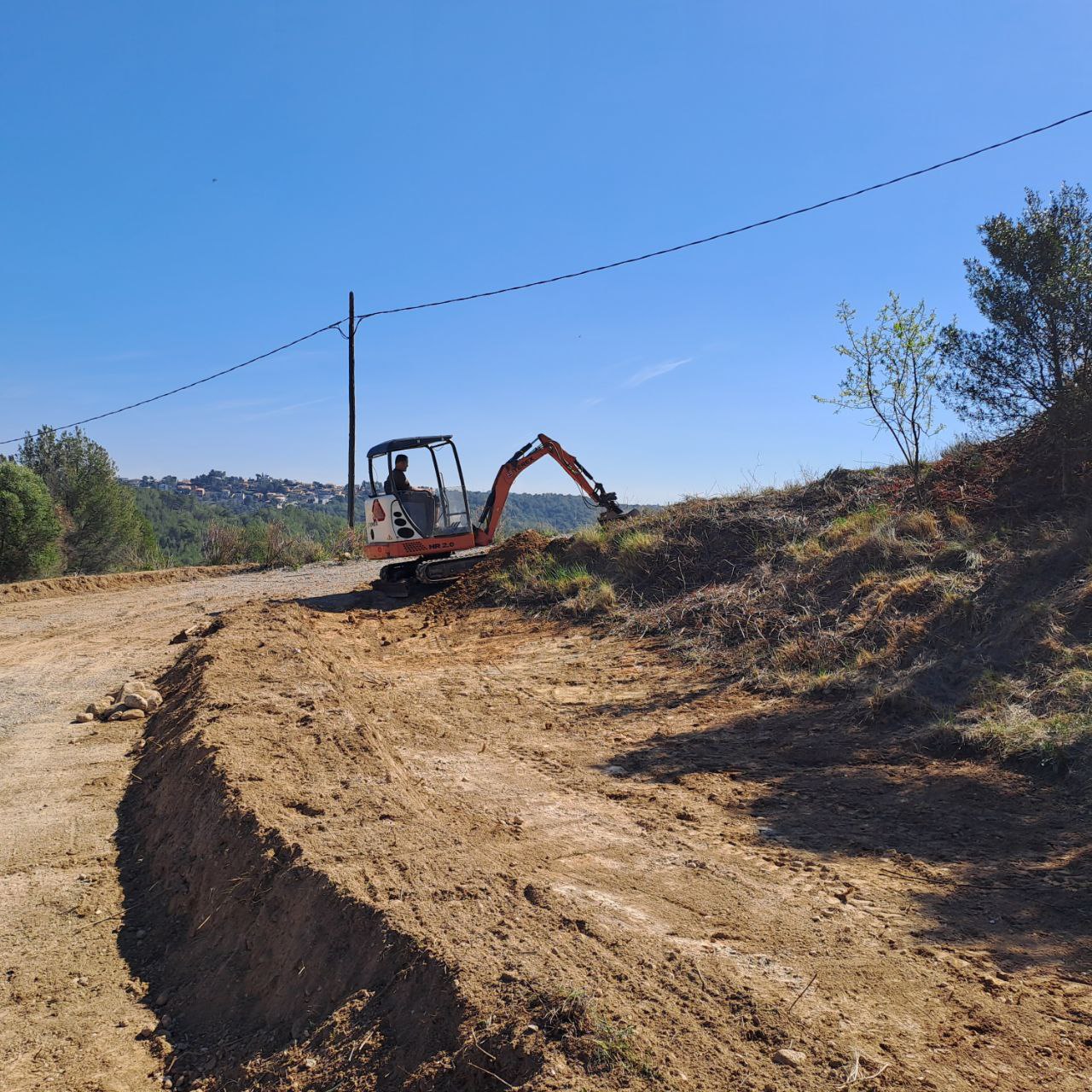
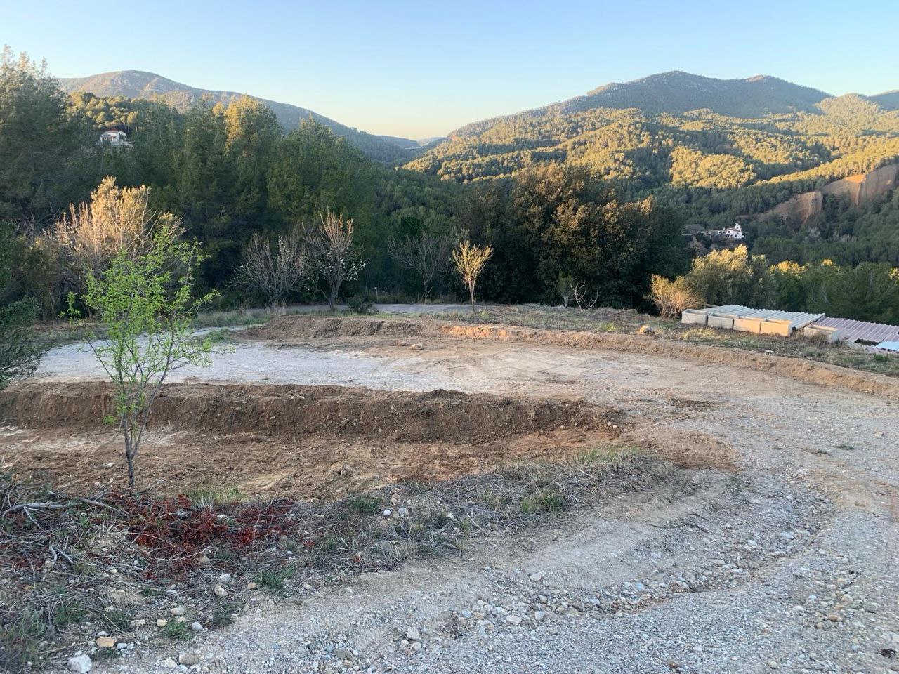
INTERVENING
A tracked rotary excavator is an ideal companion for implementing the designs… plus hoe, shovel, rake and compactor. Since in some cases we will have to work out details manually.
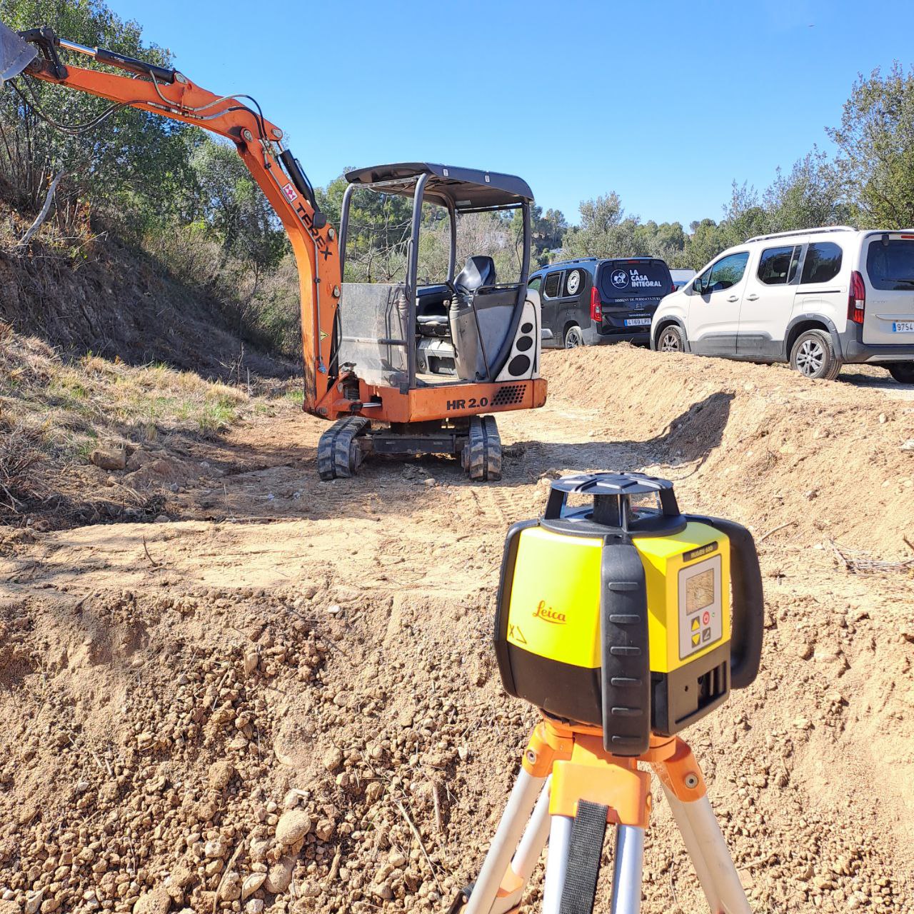
The execution of a Hydrological Design requires constant observation and attention to the different geological layers or singular elements hidden in the landscape (roots or large stones), in order to make adaptations as needed, and precise level tools to help us generate slopes, small dams ( spillways are very important!), swales, superelevations, etc.
This technique can be applied in clay, forest, sandy or cultivated soils and it is becoming more and more necessary and urgent to do so. Although it may seem an important investment, we believe that it is, as few others, one of the most profitable, since its ERR (Energy Rate of Return) increases exponentially year after year.
The climatic and meteorological reality, the guarantee of food sovereignty of each territory, the health of our ecosystems, which is ultimately our own…. All these factors require us to redesign landscapes at all scales. We believe that we must apply a regenerative approach that increases the carrying capacity of ecosystems, recharging aquifers, reducing fire risks and increasing biodiversity.
At La Casa Integral we are passionate about this type of design and we have been able to form a team of professionals, all trained and qualified to advise, design and implement all types of Hydrological Strategies, from landscape interventions as we have explained in this article, to regeneration and wastewater reuse systems. regeneration and reuse of wastewater and rainwater harvesting and storage systems.
Does landscape regeneration call out to you?
Call us to talk about it?
Be water, my friend!